Drone Survey Devon
Thermal Survey
A radiometric thermal camera added to the flight, for tracing an active leak or reading heat loss anywhere in the coverage area.
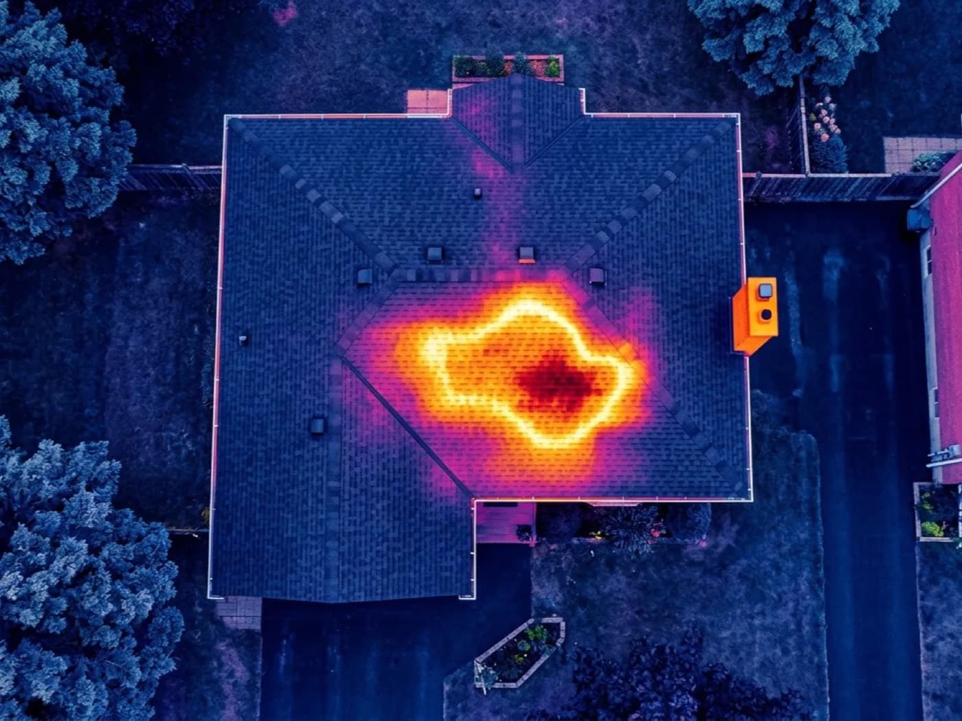
Most survey bookings do not need thermal. It gets added where there is an active leak nobody can trace, or a flat roof that may be holding water inside the build up, wherever in Devon that property happens to be.
Water and the materials around it hold and release heat differently from dry ones, so a wet patch under a covering can show as a temperature difference well before it shows as a stain on a ceiling. It needs the right conditions on the day to work, and that gets checked as part of booking rather than promised in advance.
What is included
- DJI Mavic 2 Enterprise Advanced radiometric thermal camera
- Flown alongside the standard visual survey, same visit
- Useful for leak tracing and general heat loss reading
- Travel across the county included in the fixed price
- A written report within 48 hours with both visual and thermal images
When thermal is worth adding
The clearest case is an active leak that has already shown up inside but cannot be pinned to a location from the ground. The second clearest is a flat roof, where ponding and a failing membrane are hard to judge from a visual pass alone.
Thermal is not a substitute for the visual survey and it is not run as a standalone service on its own; it sits alongside the roof survey and adds a second layer of evidence where a straightforward visual pass has not settled the question.
On the day
How a thermal survey runs
- Step 1
Suitability check
Thermal work depends on the temperature difference between inside and outside on the day, so this gets discussed before booking rather than assumed.
- Step 2
The flight
Visual and thermal passes flown together, so the two sets of images can be compared directly against each other.
- Step 3
The report
Thermal frames paired with the matching visual image and a plain description of what the temperature difference suggests, within 48 hours.
Behind the work
Kit, cover and qualifications
Devon based, county wide
Working from Exeter and covering the whole of Devon, plus the nearest towns across the Cornwall, Somerset and Dorset borders. Travel is inside the fixed price.
CAA registered
Operator ID and Flyer ID held, plus the A2 Certificate of Competency. Every flight is planned to the rules that apply to the site, wherever in the coverage area it is.
100 megapixel camera
A DJI Mavic 4 Pro with a Hasselblad camera and 6K video. The resolution that lets a survey stand off a building at a safe distance and still show real detail.
Insured with Coverdrone
Full commercial cover for the operation. Certificates go to managing agents, committees and insurers as a matter of course.
Thermal survey
Thermal Survey questions
- Can thermal be booked on its own?
- It is flown as an addition to a roof survey rather than a separate visit, so the visual and thermal images can be read side by side.
- Does weather affect thermal readings?
- Yes. It needs a reasonable temperature difference between inside and outside to show anything useful, which is checked before the flight is booked rather than left to chance.
Where
Thermal Survey across the South West
Also on this site
Call now
Book a survey with Drone Survey Devon
Tell us the address and what you need looking at. Sam Hembury will come back with a fixed price and the next available slot.