Drone Survey Devon
Aerial Photography
100 megapixel stills and 6K video from the Mavic 4 Pro, for anyone who wants the images rather than a survey report.
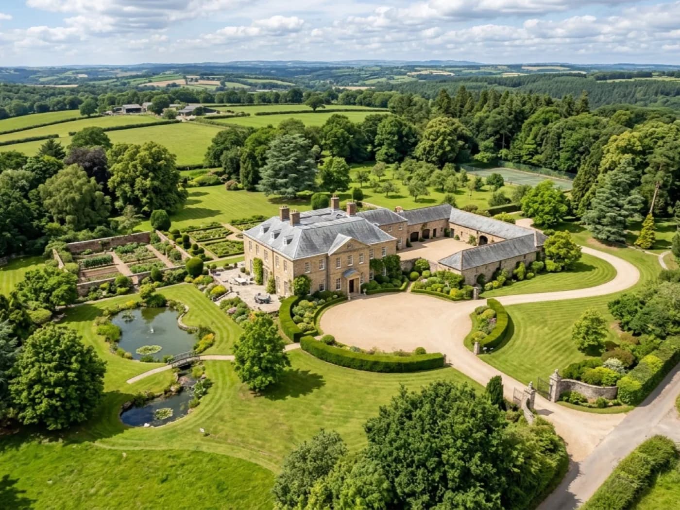
Not every booking is about condition. Sometimes what is wanted is simply a good aerial photograph or a piece of video, of a property, a site or a piece of land, anywhere across the coverage area.
The same aircraft used for survey work carries a 100 megapixel Hasselblad camera and shoots 6K video, so the same booking that flies a survey can also come away with usable marketing or record imagery if that is what is needed.
What is included
- 100 megapixel stills from the DJI Mavic 4 Pro
- 6K video where that is the better format for the job
- Travel across the county included in the fixed price
- Edited images or footage delivered inside a few days
Where this gets used
Estate agents wanting a property to stand out, landowners wanting a record of a site, and anyone who simply wants a good aerial photograph of somewhere in Devon they care about. It is booked on its own, separately from survey work.
On the day
How a aerial photography runs
- Step 1
Brief agreed
What the images are for, roughly how many shots or how much footage, and any specific angles wanted, agreed before the visit.
- Step 2
The flight
Timed for good light where possible, and flown to the brief rather than a fixed survey pattern.
- Step 3
Delivery
Edited stills and any video handed over inside a few days, in a format that is ready to use.
Behind the work
Kit, cover and qualifications
Devon based, county wide
Working from Exeter and covering the whole of Devon, plus the nearest towns across the Cornwall, Somerset and Dorset borders. Travel is inside the fixed price.
CAA registered
Operator ID and Flyer ID held, plus the A2 Certificate of Competency. Every flight is planned to the rules that apply to the site, wherever in the coverage area it is.
100 megapixel camera
A DJI Mavic 4 Pro with a Hasselblad camera and 6K video. The resolution that lets a survey stand off a building at a safe distance and still show real detail.
Insured with Coverdrone
Full commercial cover for the operation. Certificates go to managing agents, committees and insurers as a matter of course.
Aerial photography
Aerial Photography questions
- Is this the same aircraft used for surveys?
- Yes, the DJI Mavic 4 Pro. The camera resolution that makes a survey report useful is the same resolution that makes a photograph worth using.
Where
Aerial Photography across the South West
Also on this site
Call now
Book a survey with Drone Survey Devon
Tell us the address and what you need looking at. Sam Hembury will come back with a fixed price and the next available slot.